While the rest of you were probably trying to ignore the World Series as best as you could, I spent a few days on vacation in Austin, Texas before returning and taking a couple more days to revisit Shasta and Oroville. As some of you know, I’ve kind of been keeping very close tabs on the levels of both reservoirs ever since I went, detailed here.
With winter approaching soon and some rain forecast by the end of the week (and my cat still in the pet hotel), I was off for Redding for the night within hours of my flight returning. Last Tuesday was spent at Shasta Lake, where I started out by retracing my steps around Doney Creek and Charlie Creek, which I viewed and shot a little differently than back in February.
Then I went back to Sugarloaf Marina and Beehive Camp (all accessible starting from the Lakehead area), and that’s where a couple things that hadn’t been visible during February’s visit were now. The day finished with a stop at Bridge Bay, Shasta Dam (along with a tour), and on to Oroville for the night.
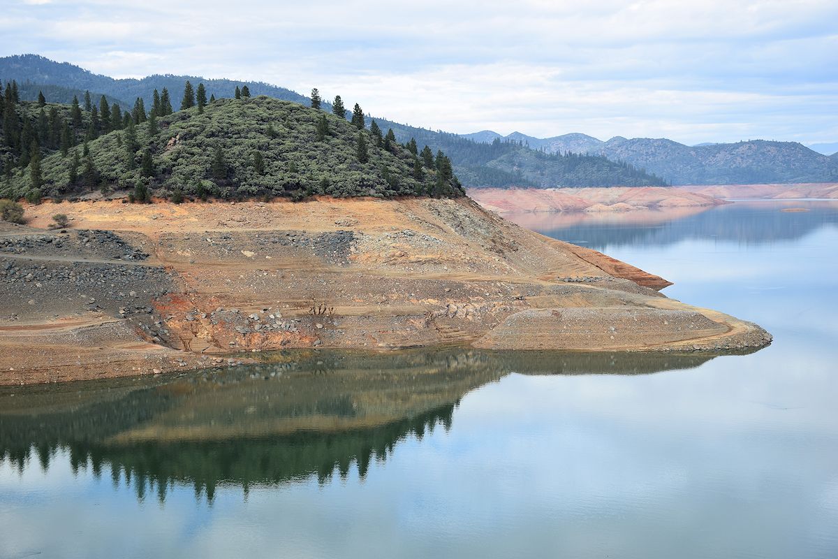
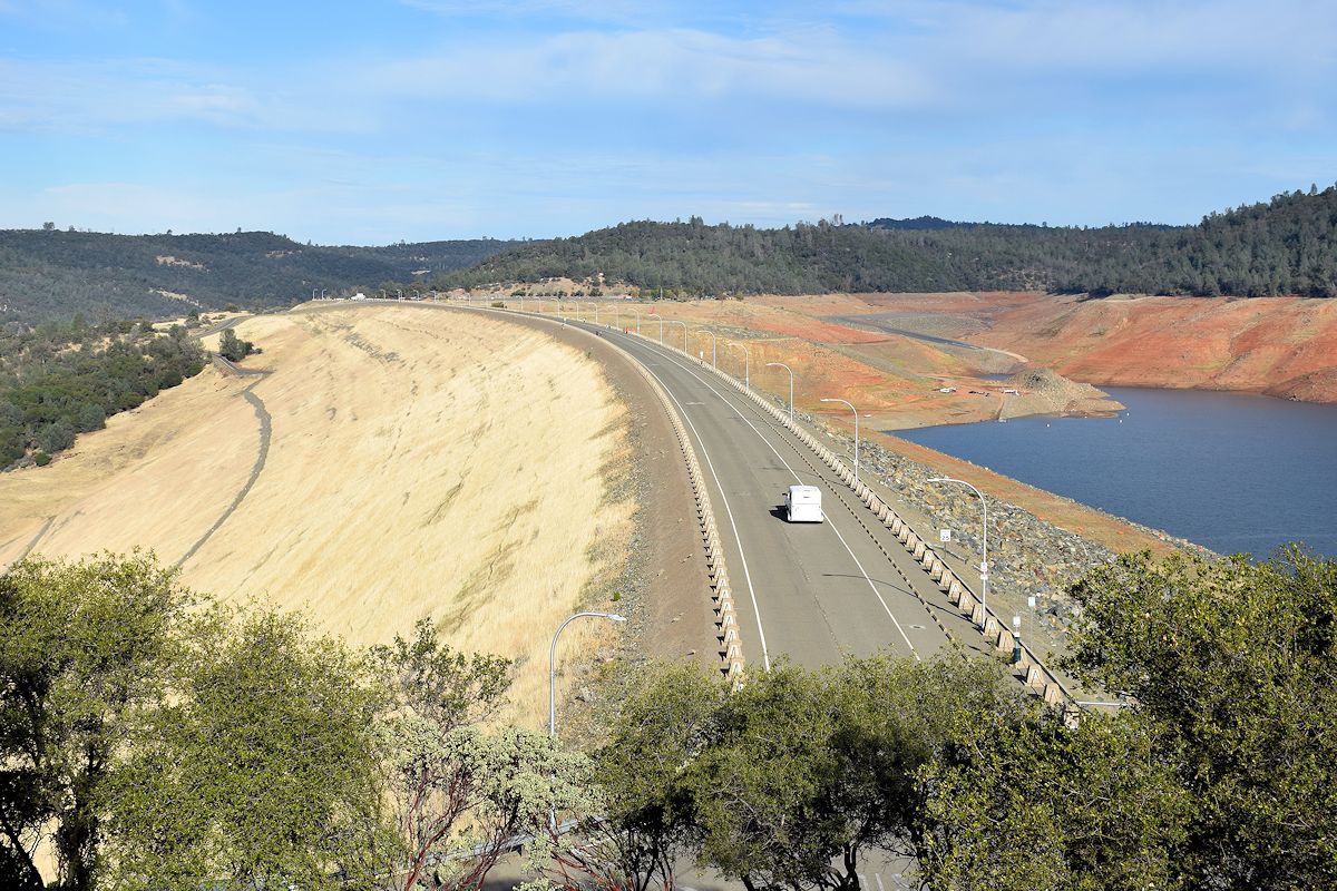
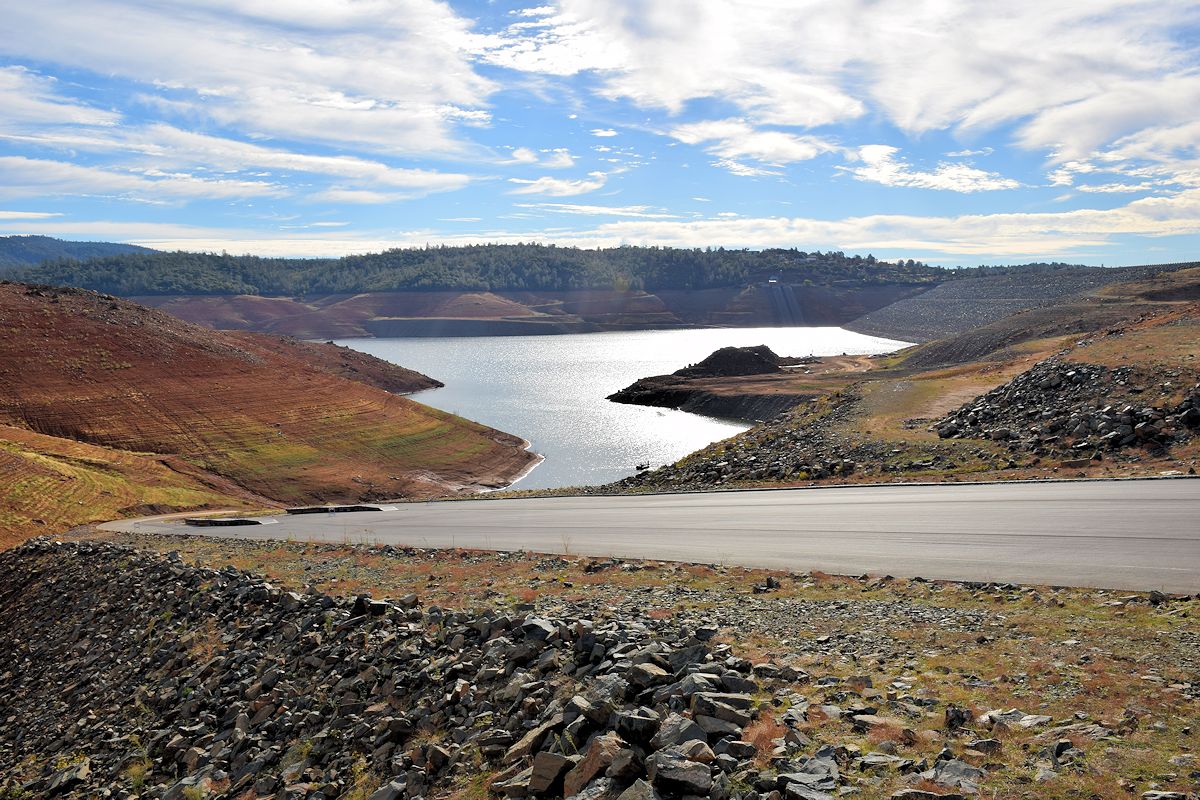
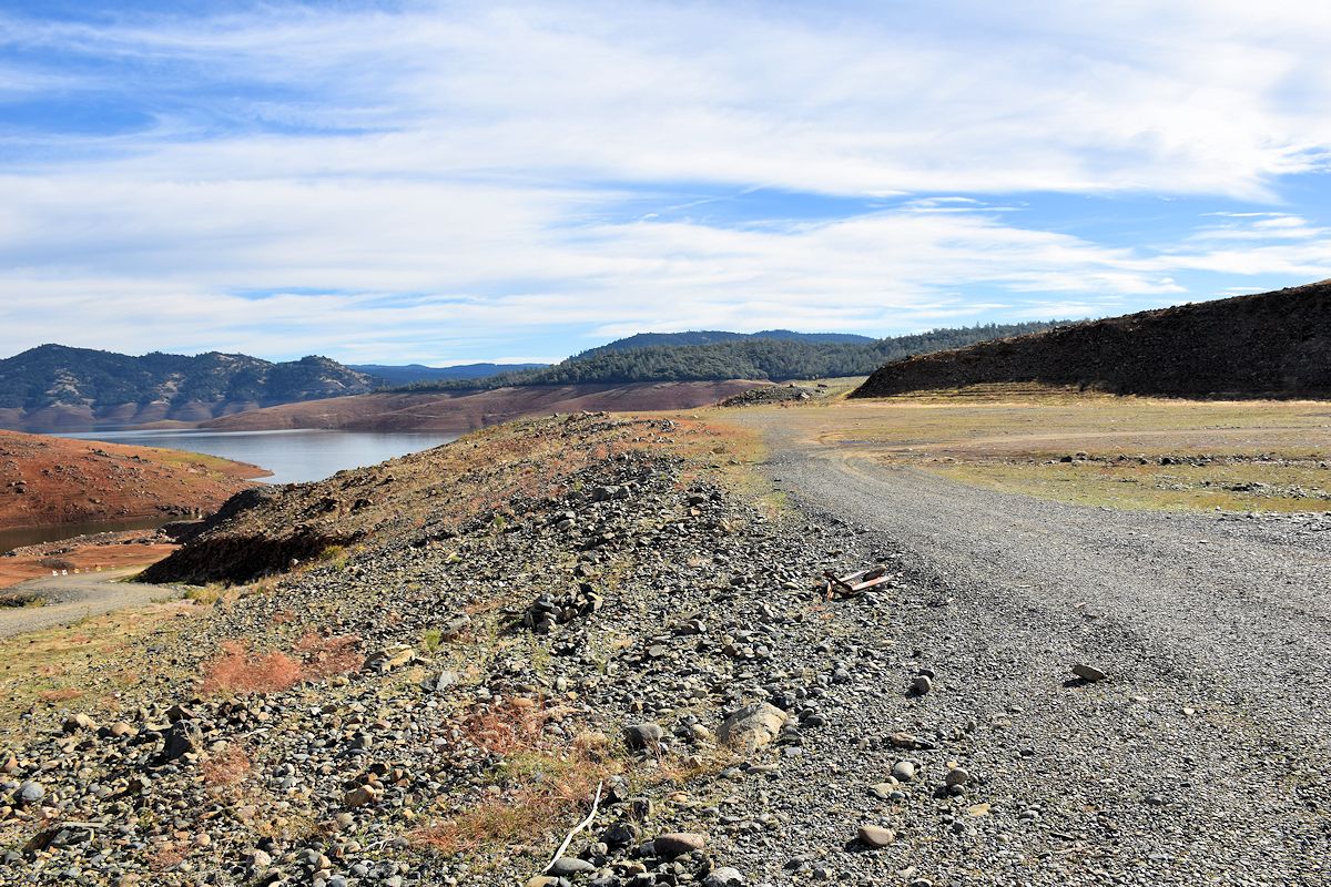
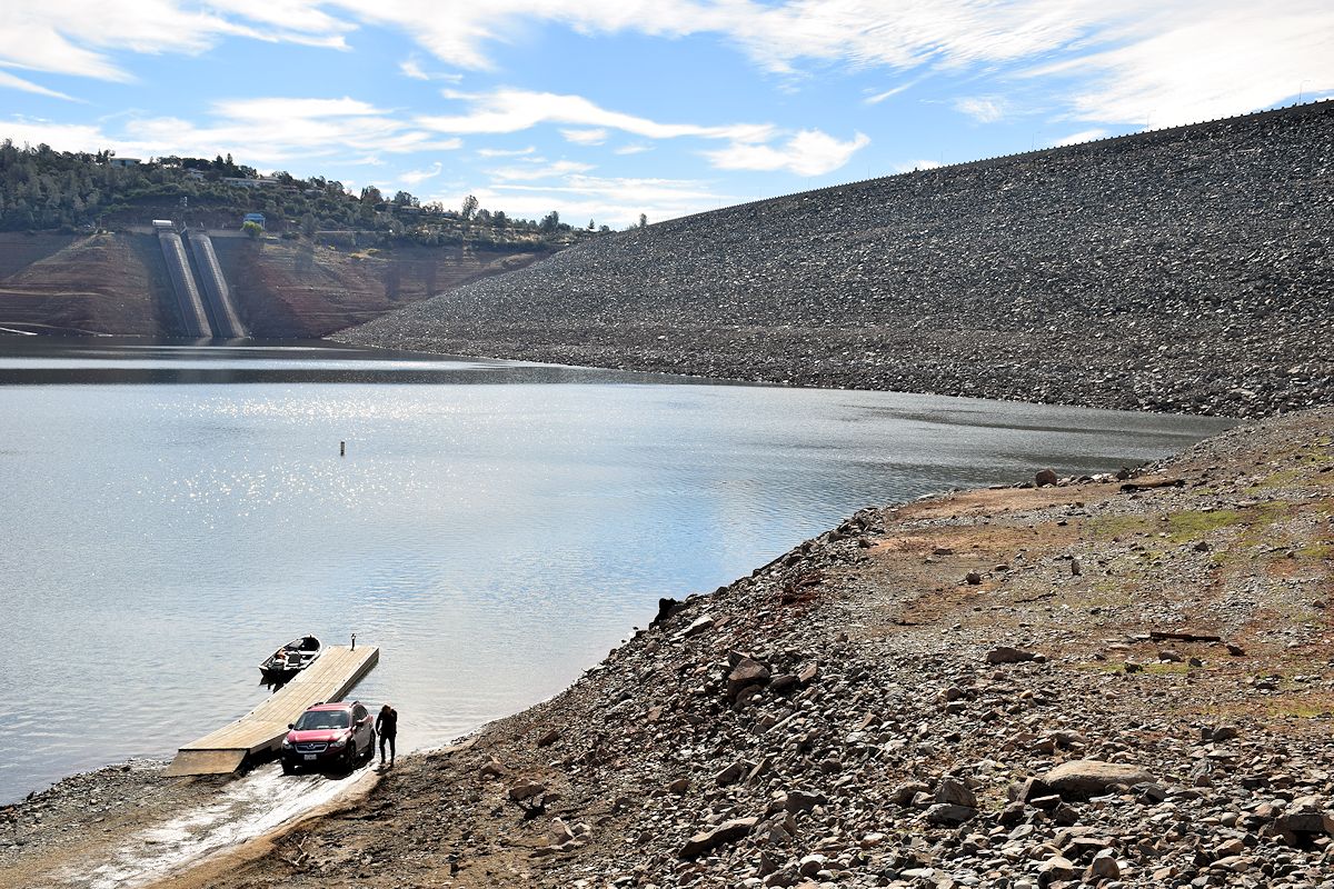
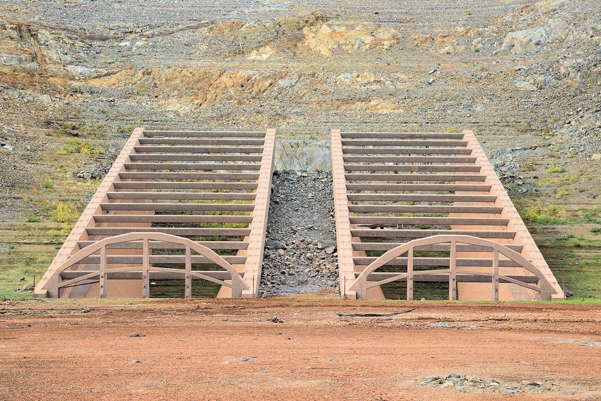
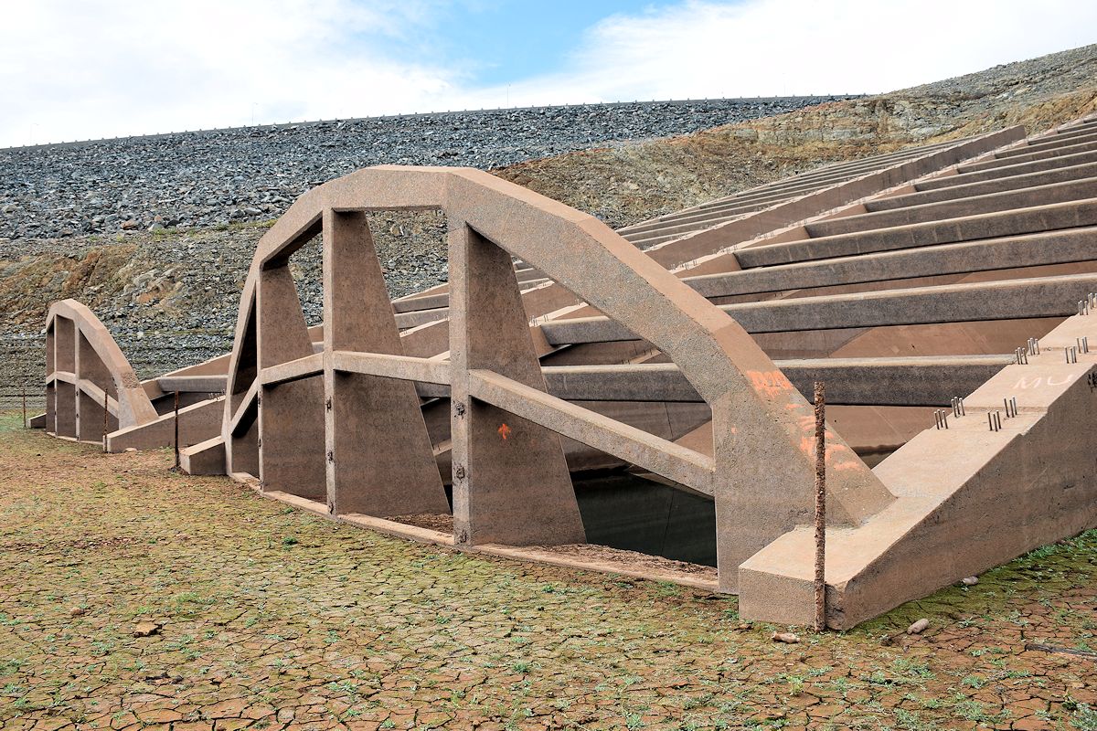
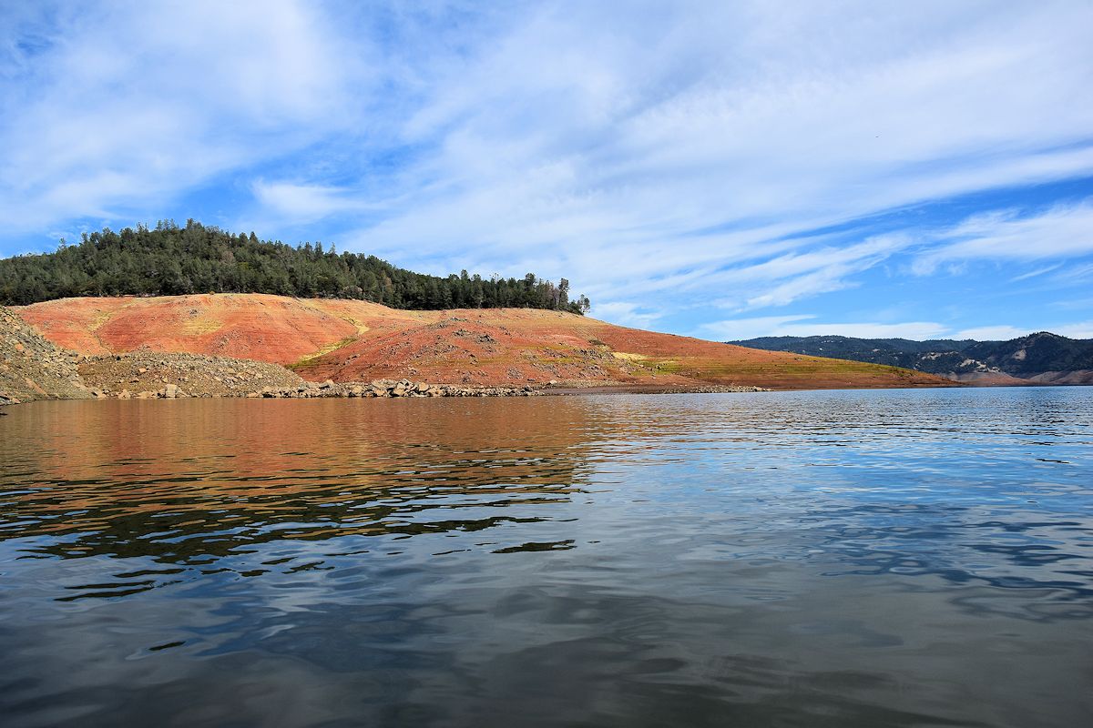
Wednesday was just a couple hours or so at Lake Oroville, similar to how I did things at Shasta. With the lake’s level much lower (more on that in a moment), it meant I could access areas I didn’t get to before, including a close-up look at a couple new intakes they’ve been building but have (at least for now) halted work on.
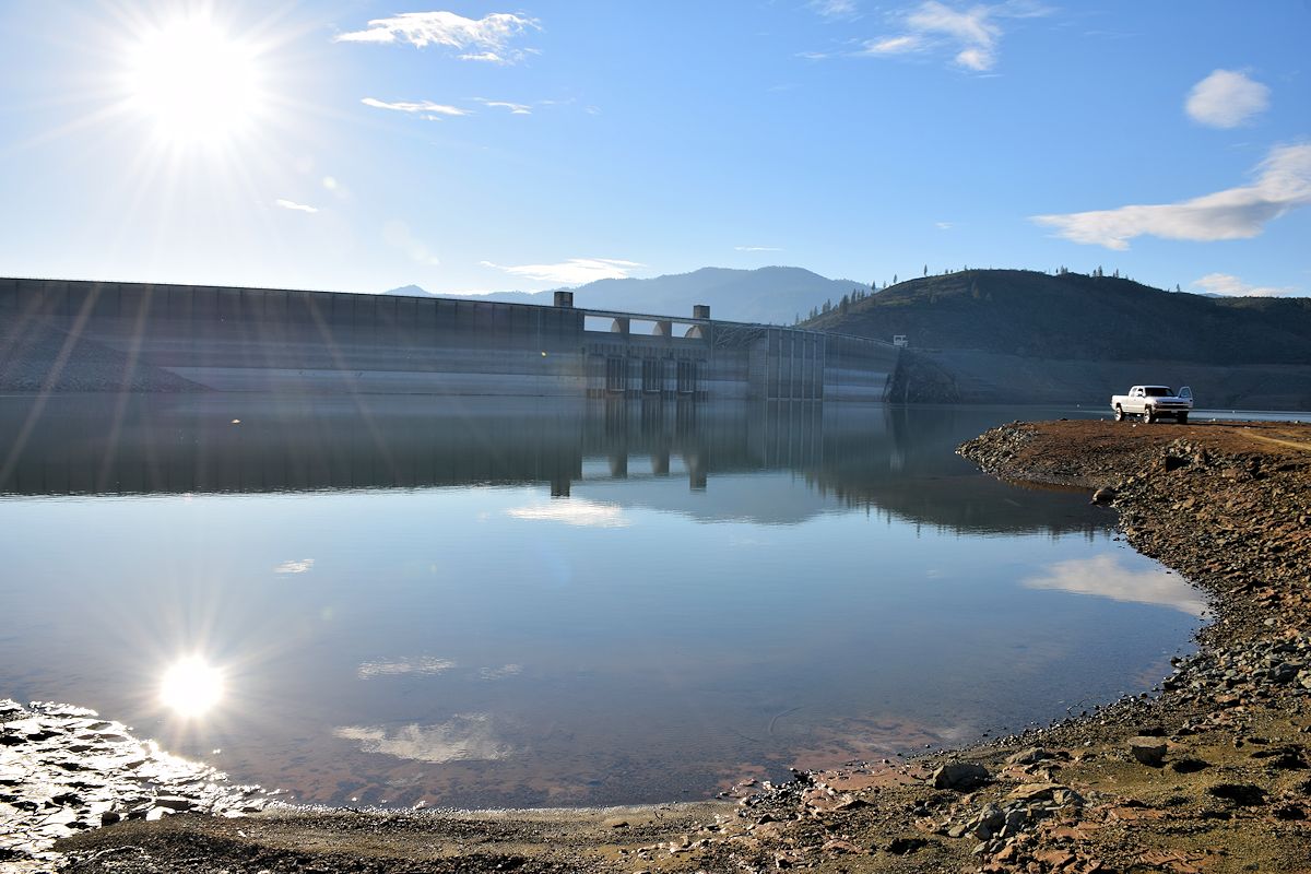
Pertinent details for Shasta: Lake elevation on this day (10/28/14) was 895.09 feet, storage of 1,109,778 acre feet (AF). When visited previously 2/17/14, elevation was 939.60 feet, storage of 1,711,038 AF. That is an elevation drop of 44.51 feet in just over eight months for a reservoir that was already extremely low during the winter season. Peak storage capacity is 4,552,000 AF.
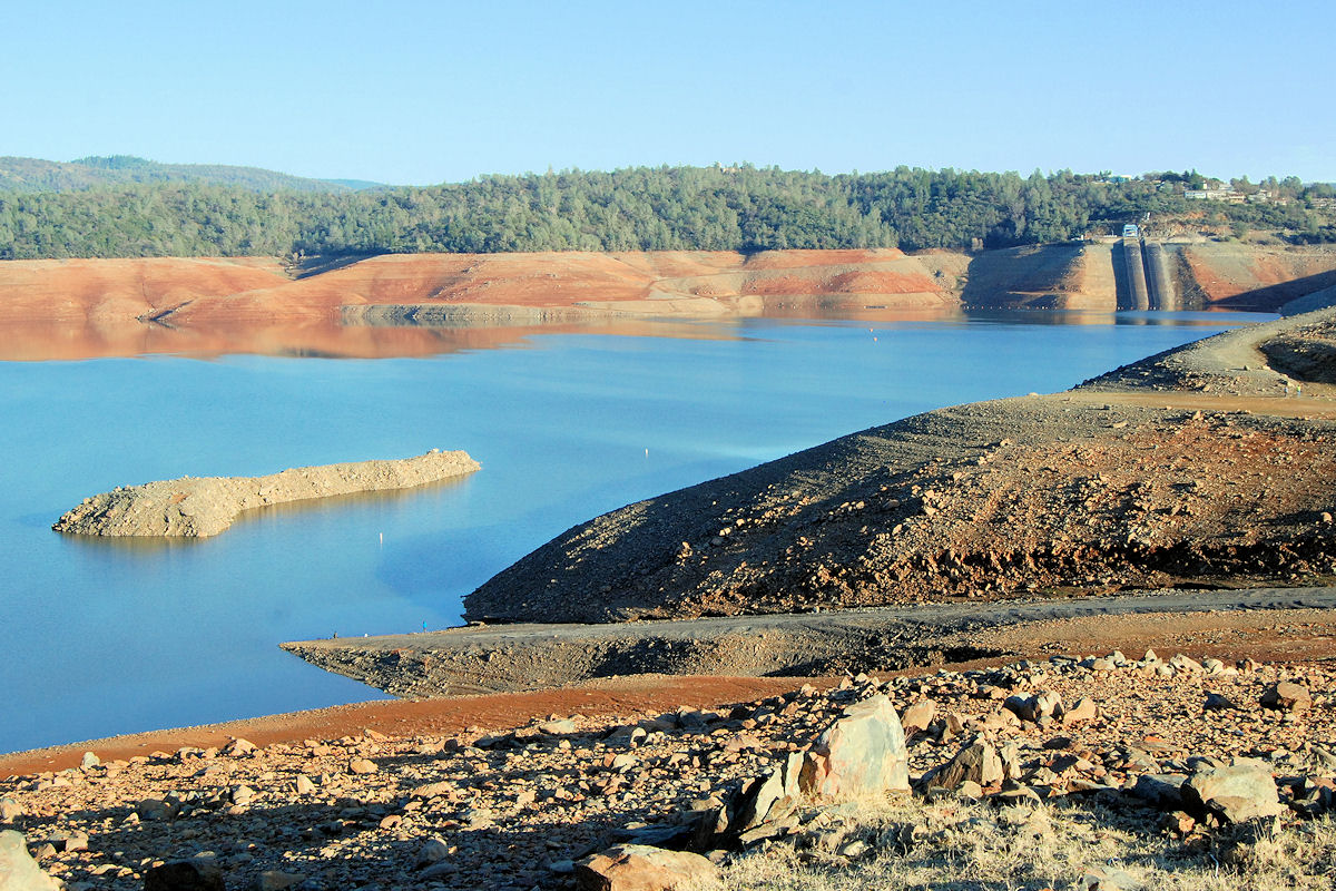
And for Oroville: Lake elevation on this day (10/29/14) was 658.33 feet, storage of 963,912 acre feet (AF). When visited previously 2/16/14, elevation was 715.11 feet, storage of 1,373,596 AF. That is an elevation drop of 56.78 feet in just over eight months for a reservoir that was already extremely low during the winter season. Peak storage capacity is 3,537,577 AF.
Adding that up, California’s two largest reservoirs have a peak capacity of a little over 8 million AF, and right now they have only about 2 million AF filled. For those of you old enough to remember 1977, Shasta got quite a bit lower than what it’s at even now.
Now I’ll share the photos, along with a few for comparison from back in February included. You can see it all here.
SHASTA LAKE SIGHTS
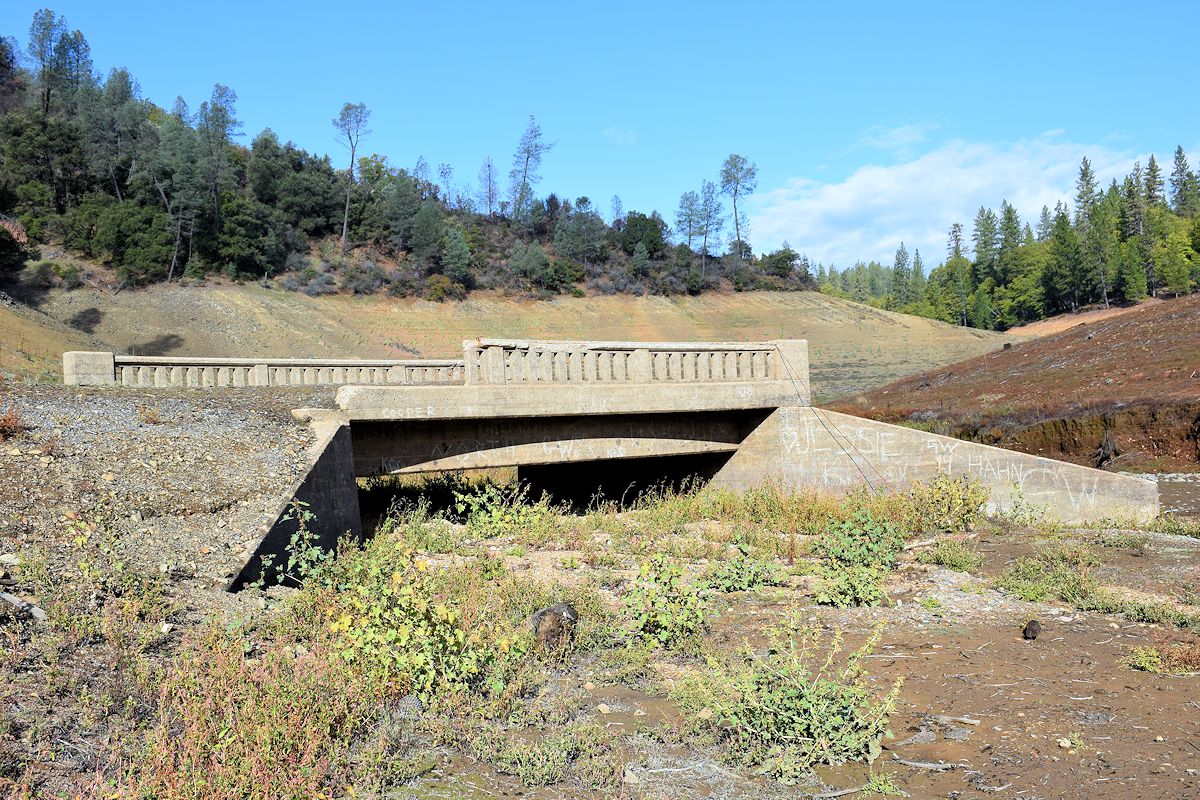
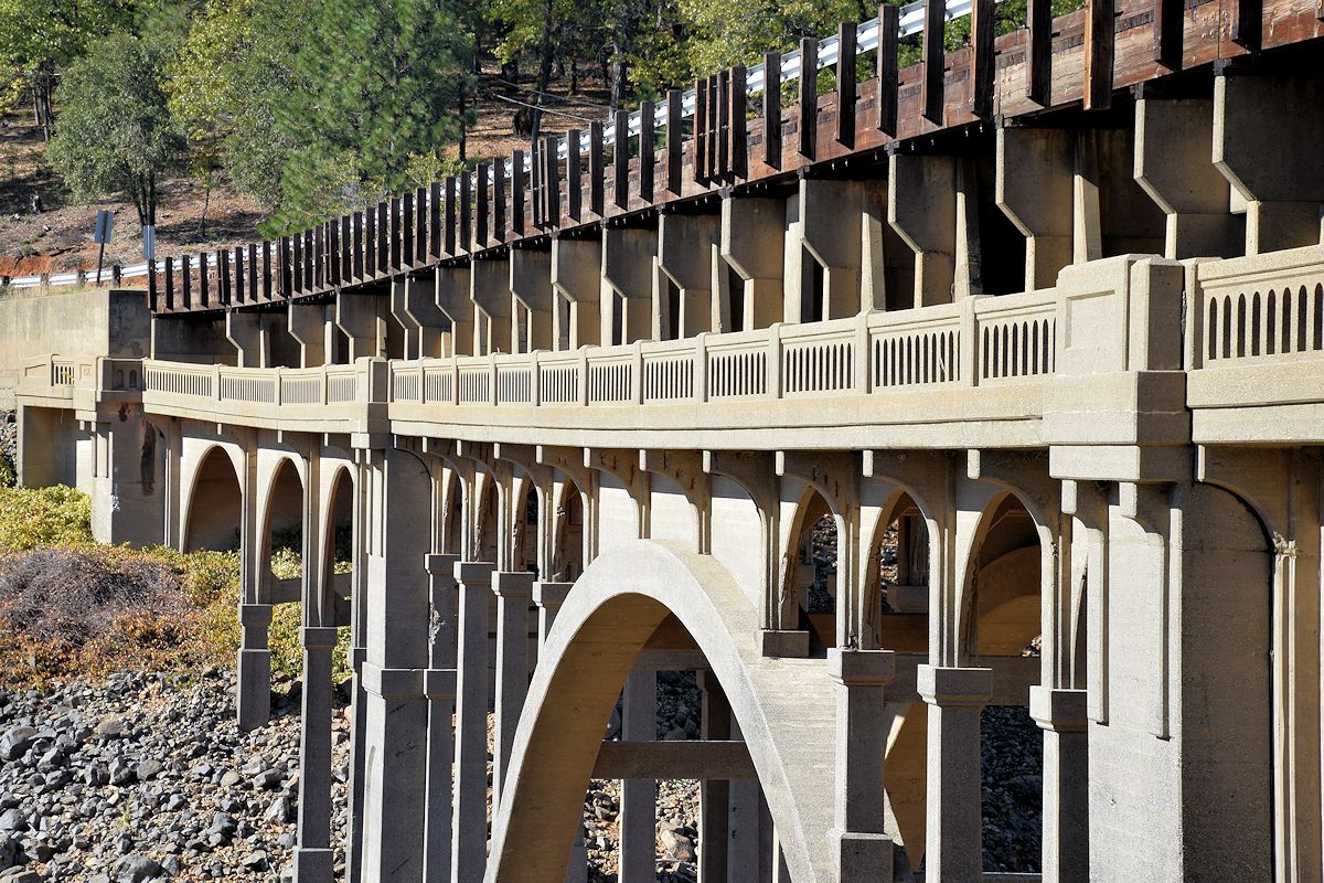
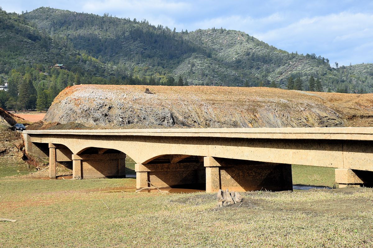
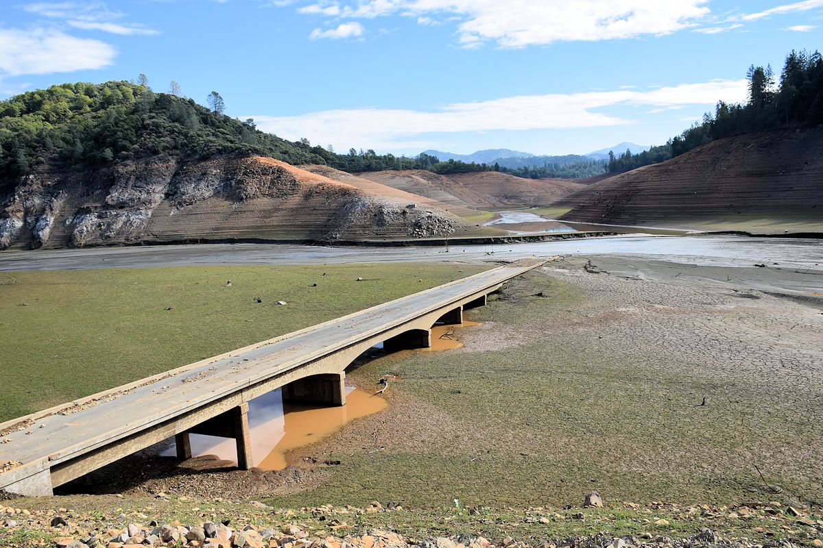
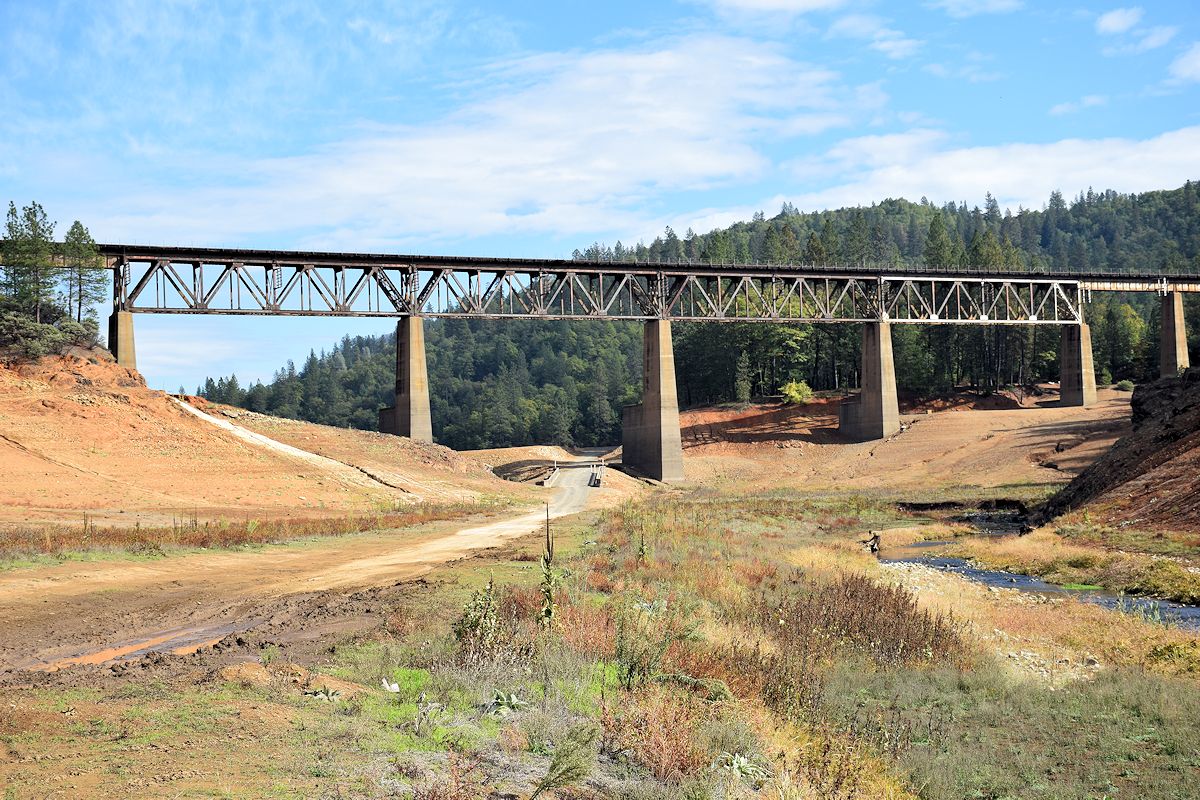
Road and rail bridges at Doney Creek. At times the level of the lake is high enough to reach the original roadway, which is why it was later raised up to the current level. You can see signs of an old tunnel beneath the arch, adjacent to where the larger body of water is flowing.

Bridge at Doney Creek, which I did not walk all the way down to the first time because I parked on the wrong side and decided to move on after taking a few photos:
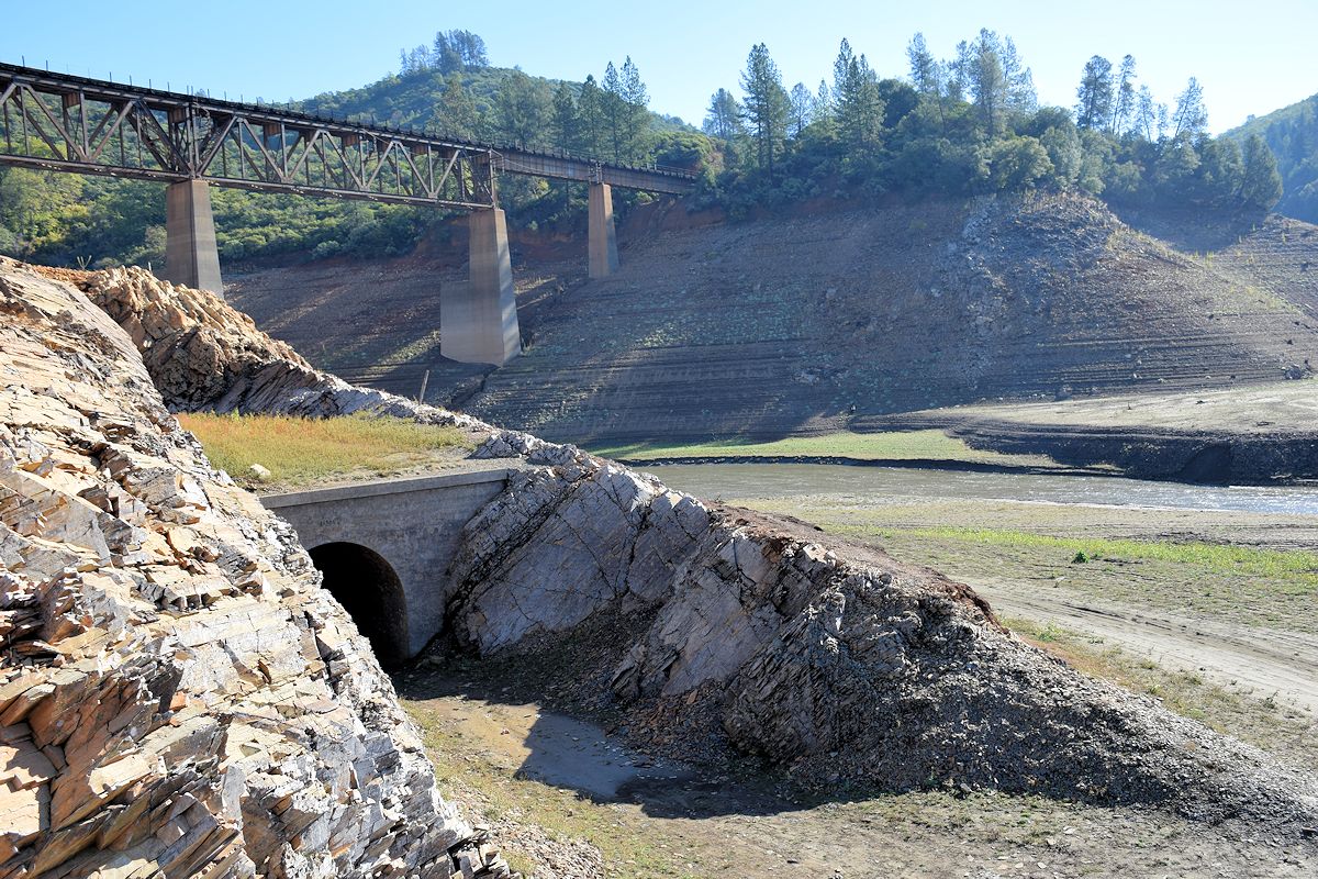
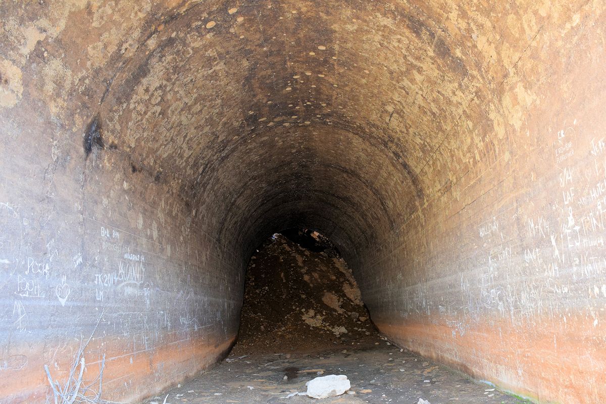
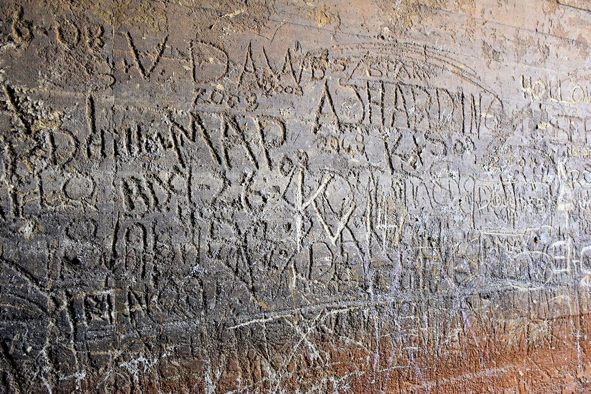
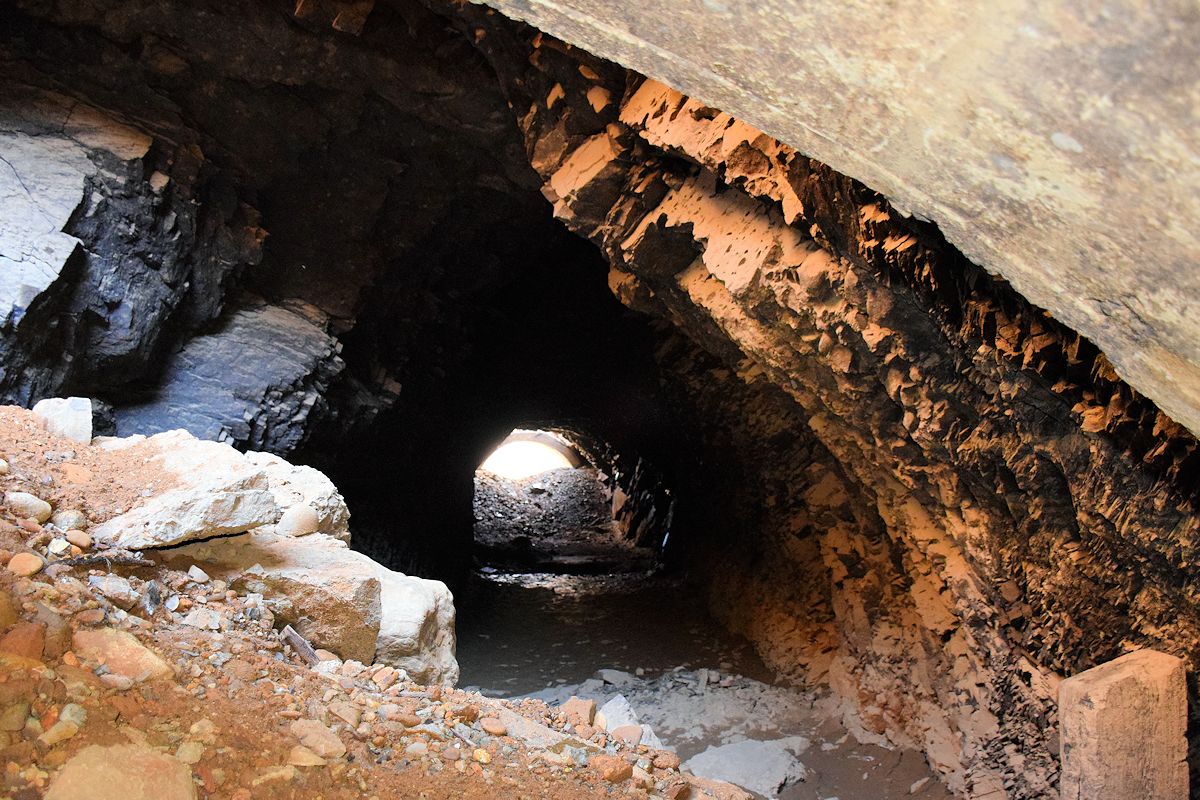
Central Pacific Railroad tunnel No. 6 at Charlie Creek. In February, the water level still reached the entrance to the tunnel and I did not go down to it. This time, I went inside. It’s easy to see that over the decades, rock and dirt caved in the area. The tunnel consists of two short concrete sections with the rest of the interior just hollowed out rock. This is probably one of the locations most easily seen when the lake’s level drops without it needing to get severely low.
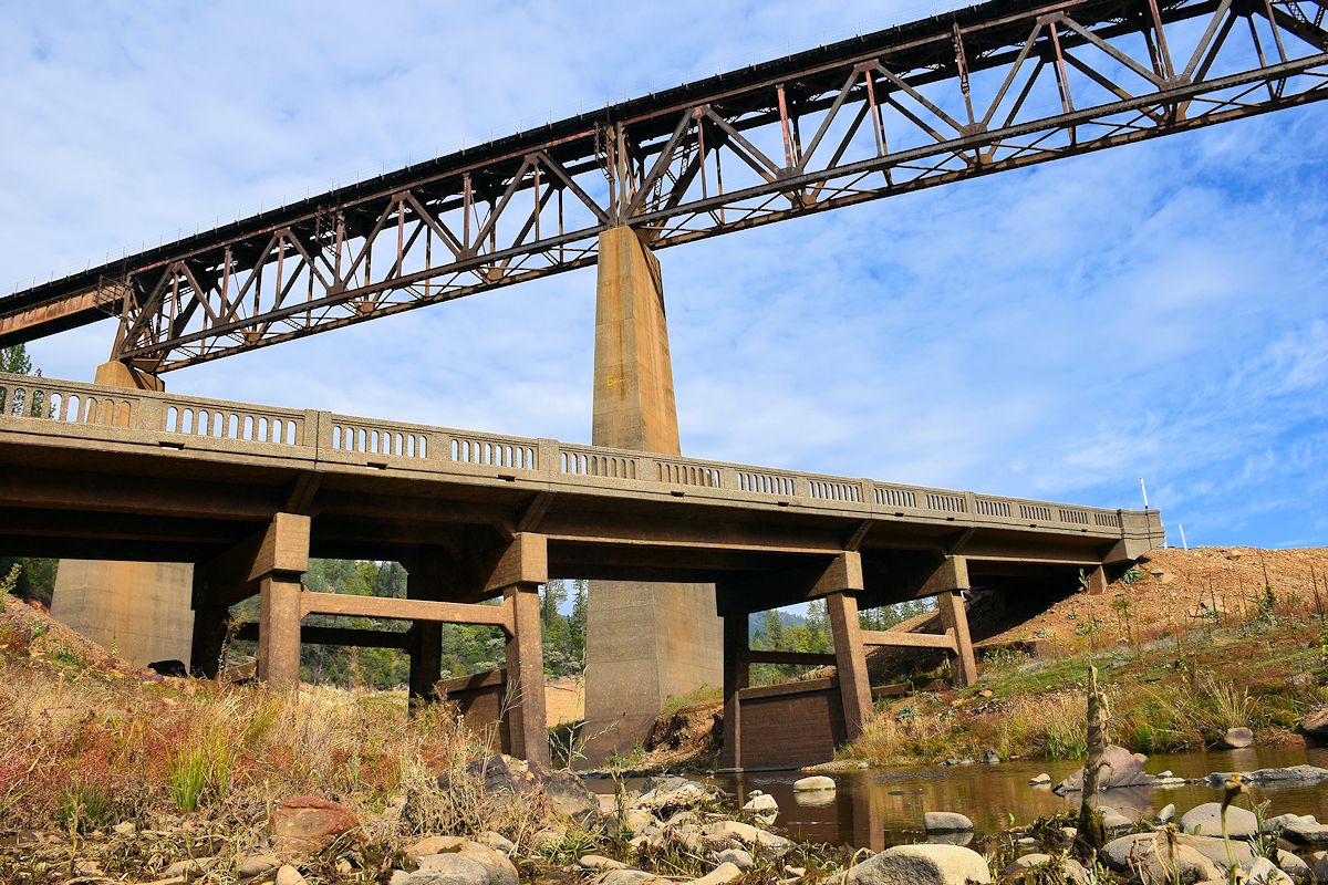
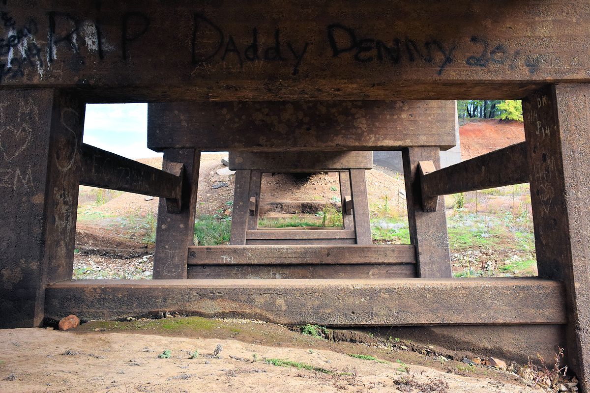
More from around Charlie Creek, including the bridge built in 1925 (similar dates exist for many structures now visible). Like the Doney Creek bridge, this one was elevated due to the peak height the lake can get to.
Here’s a comparison between February (first one) and now. It may be deceptive because this is just part of where the Sacramento River flows, and it doesn’t really indicate the extent to which the reservoir itself has dropped in the past eight months.

I was soon at Sugarloaf Marina. All of these places are within about 4 miles of the Lakehead exit off I-5, which makes them a cinch to go to one after the other. You just have to know where to look. I’d hoped to see the Pollock Bridge back in February, but the water level wasn’t low enough yet. In fact, I drove to what ended up being the exact spot it starts from, and not a single part of it was visible. Not so, this time.
Compare to this of what Pollock Bridge and the surrounding area once looked like, along with a period from 2008 where it was used as a boat launch. These two were not taken or compiled by me:


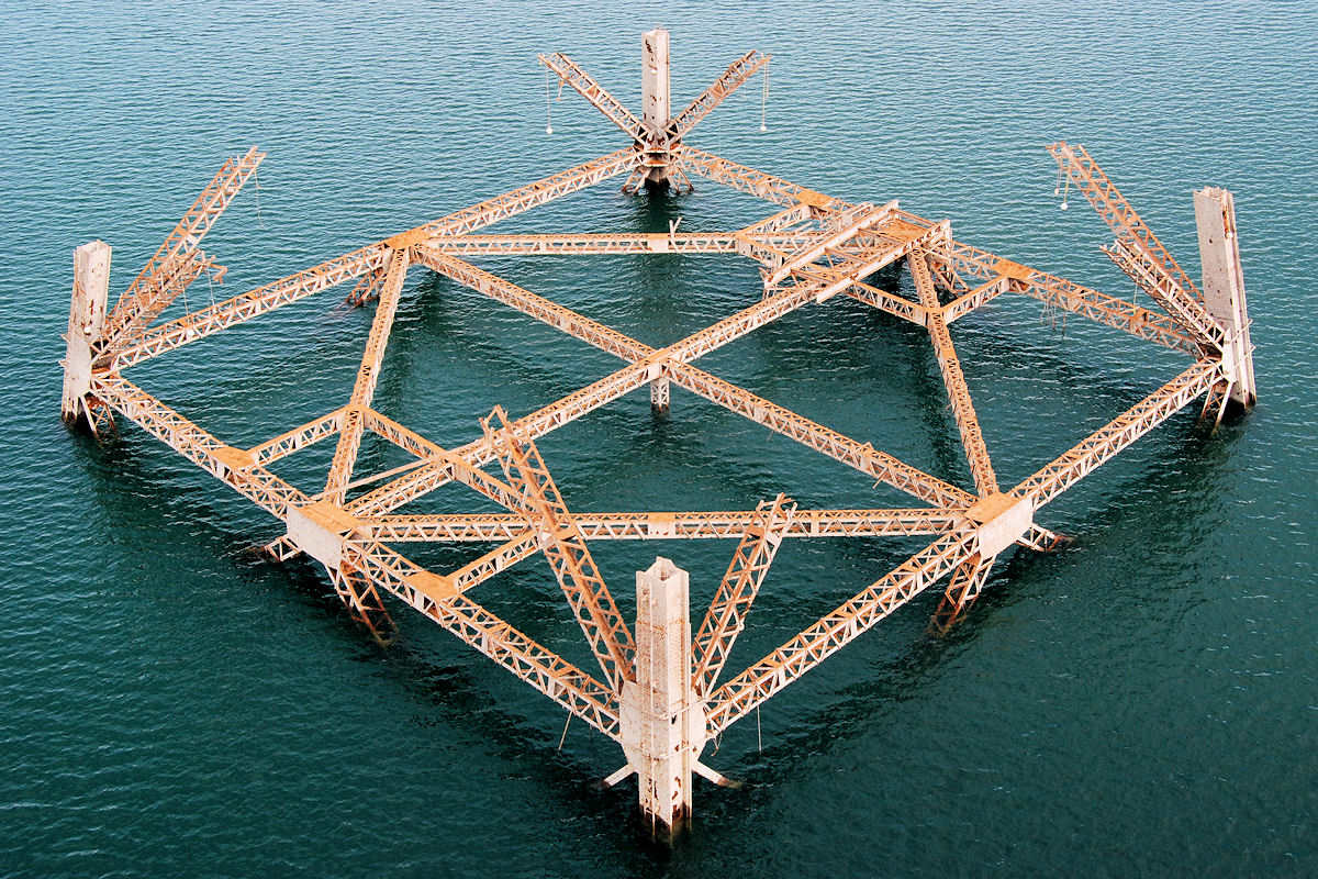
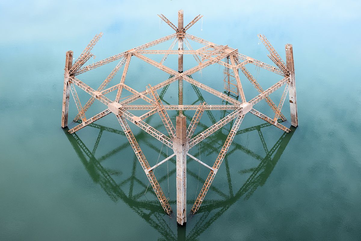
From there I drove down to Beehive Camp, which I’d actually reached in February but didn’t explore. I don’t think I’d have seen anything at the time, but when I did park there last week and guessed at a spot to walk toward, this was the first thing I spotted.
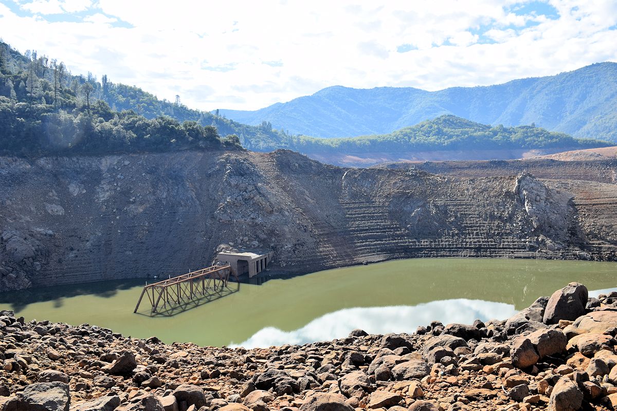
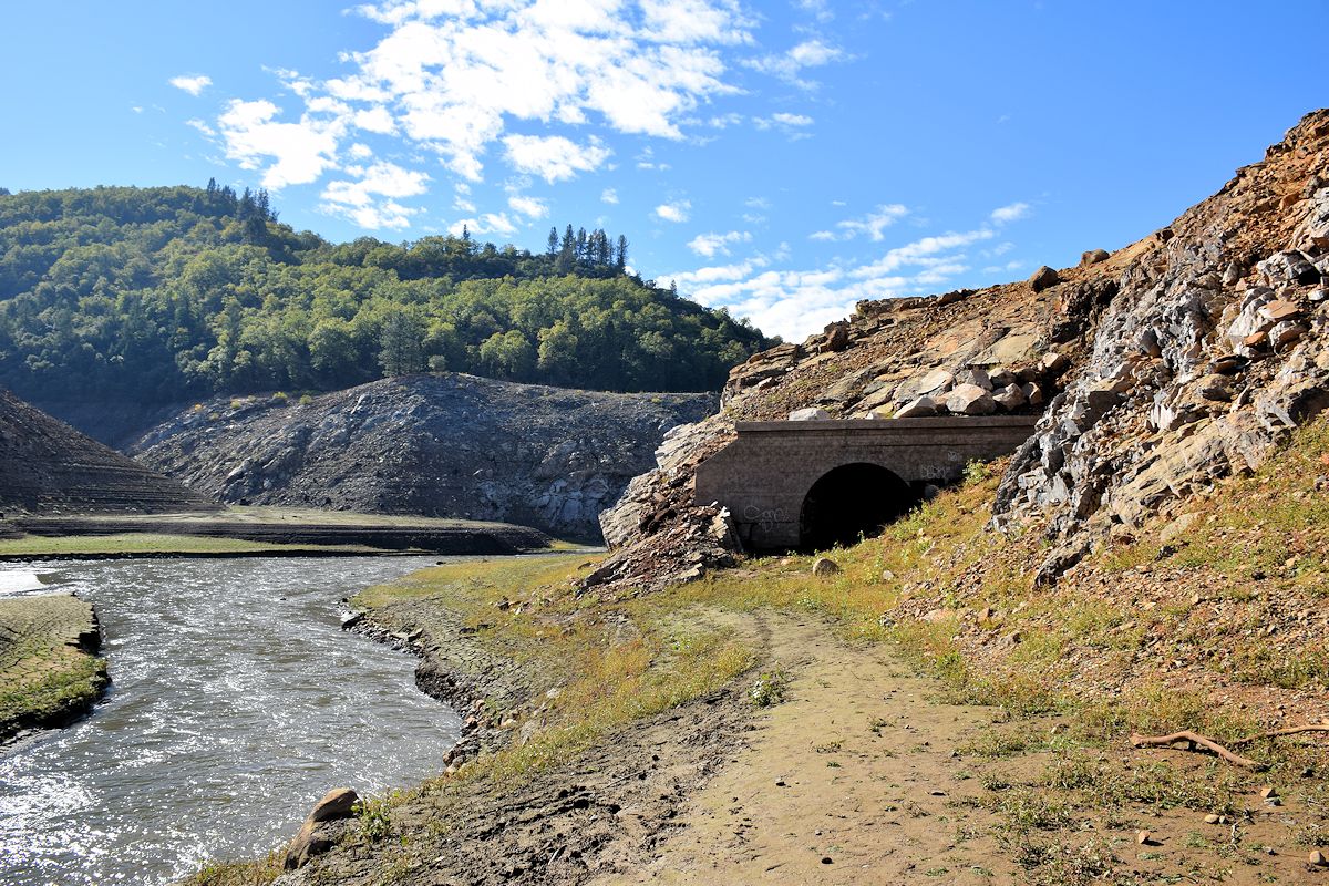
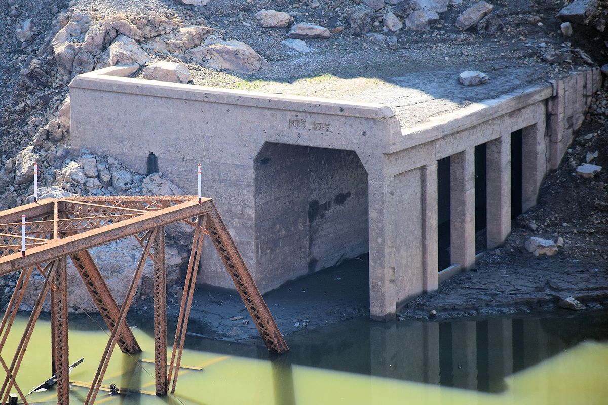
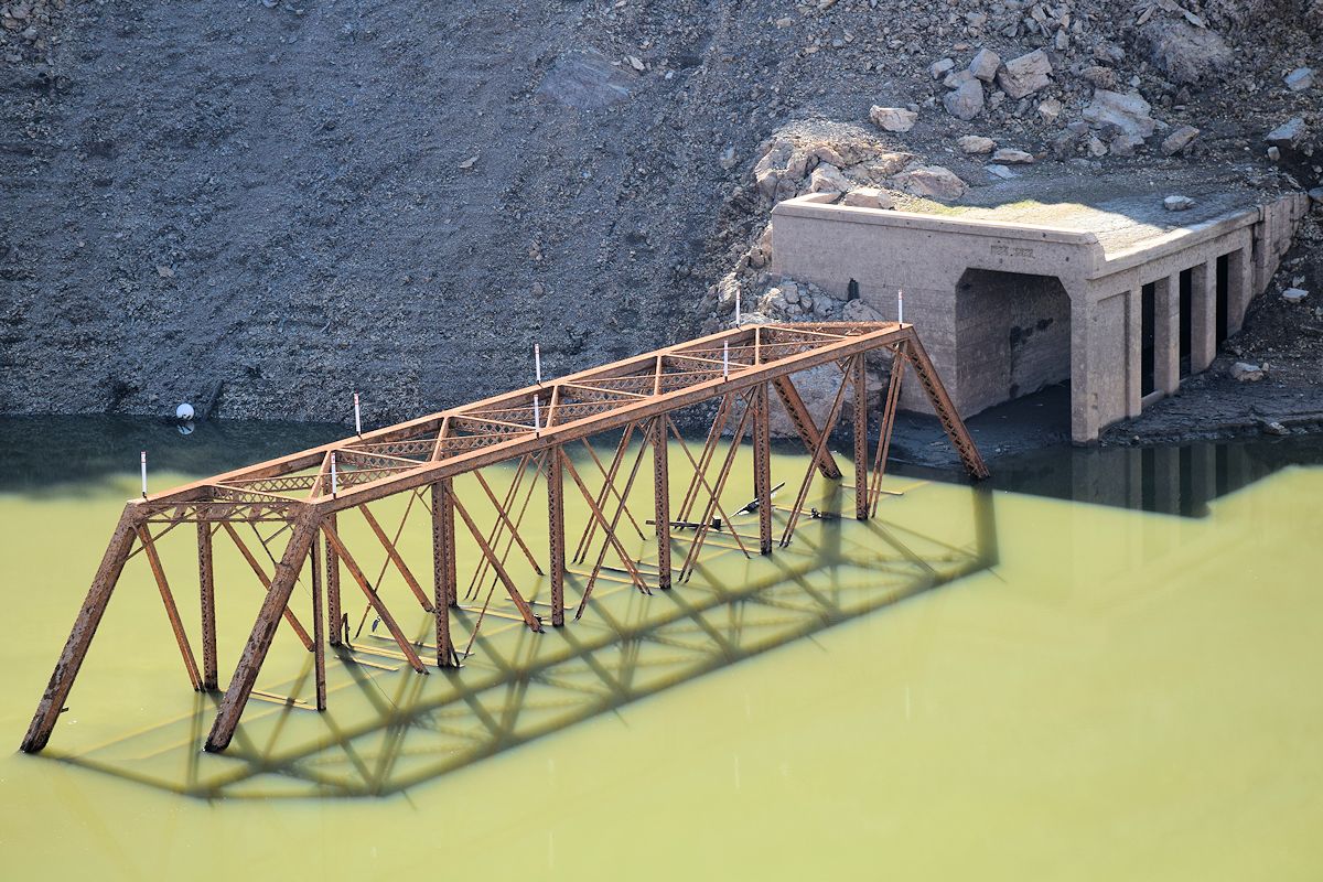
It’s the Southern Pacific Railroad tunnel No. 5 and trestle, and like Pollock Bridge it’s one of the last things that becomes visible when the reservoir drops. One of the photos shows it, but the tunnel was built in 1884 and expanded in 1927. No photos I’ve been able to find online had this much of it exposed. As I understand it, some people have taken small boats through the tunnel from one side to the other in the past.
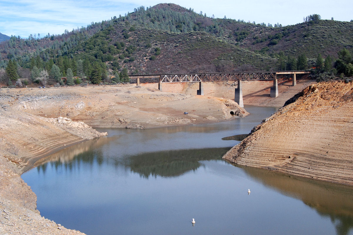
I went back to the Salt Creek Inlet and drove over the exposed bridge this time. It’s apparently the first thing that becomes visible as the lake’s level drops.
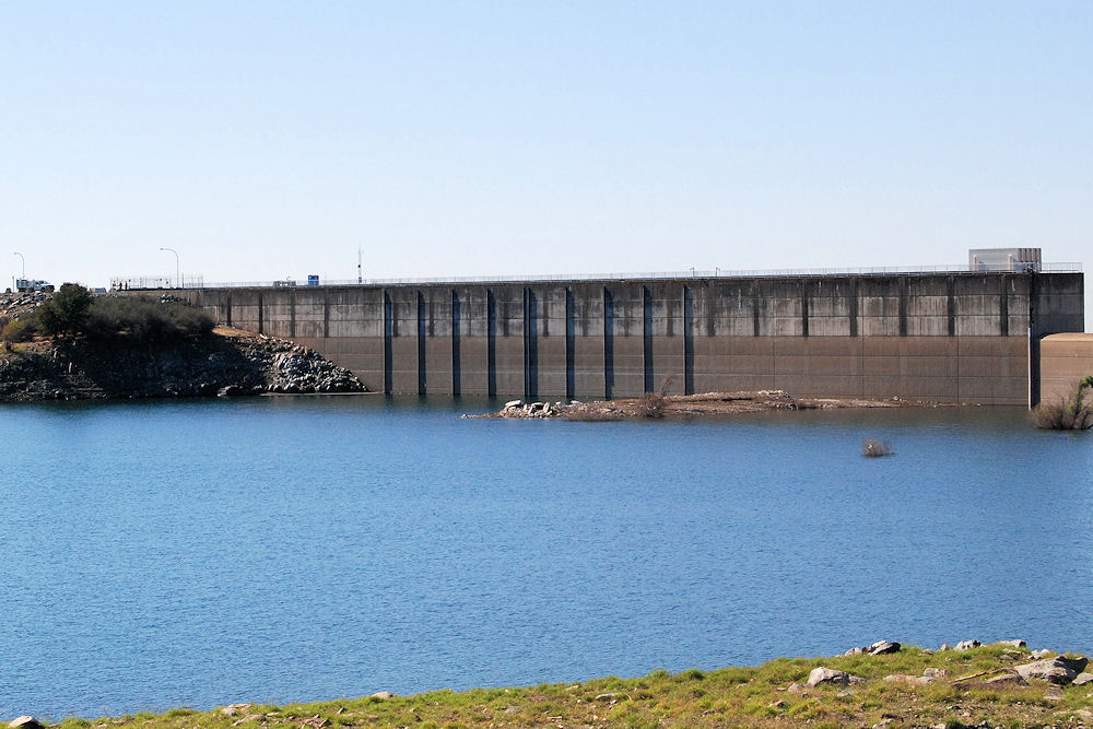
SHASTA DAM & LAKE
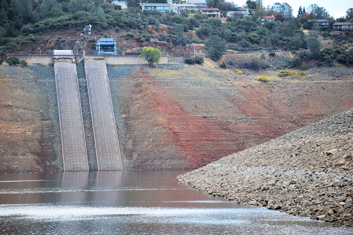
After a brief stop at Bridge Bay I went on to Shasta Dam, where I wanted to see the difference in how much of the old head tower from construction was visible. The first one is from February.
I don’t have a great before/after shot of this next one, but I hiked down to the water’s edge in February and these rocks were nearby. You should be able to spot them in the second shot for a comparison.
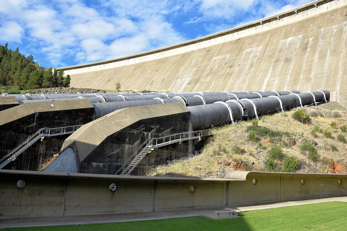
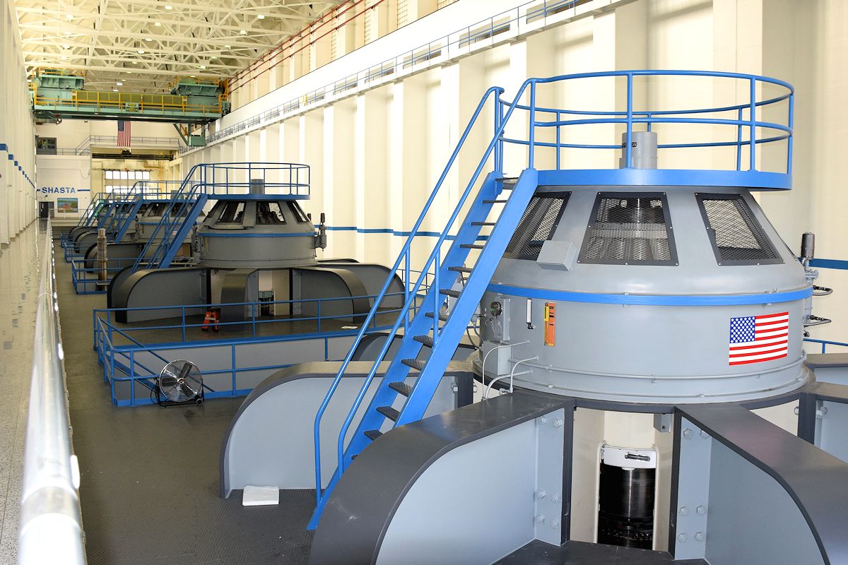
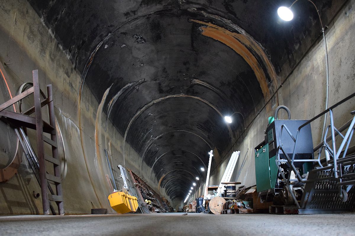
I also took the (free) tour of the dam, something I missed out on in February because I happened to go during one of the few holidays the visitor’s center was closed. It’s not quite on the level of Hoover Dam in terms of what you can see but it’s still neat, you can walk right past the generators with the tour guide, and you can’t beat the price. It’d be interesting to be down there when the reservoir’s actually high enough to let more water out. The tour also included a walk into the diversion tunnel, which served a purpose for rail at one time, the river at another, and now as storage space.
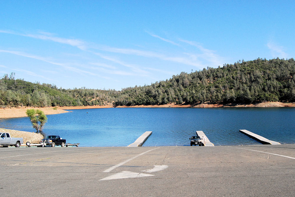
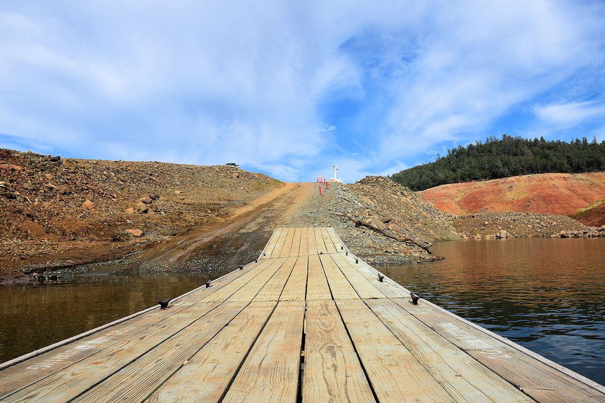
The lower the lake gets, the more ways they have to find to set up a proper boat launch. You’ll see what I mean at Oroville. This is the end of the Shasta visit.

OROVILLE DAM & LAKE
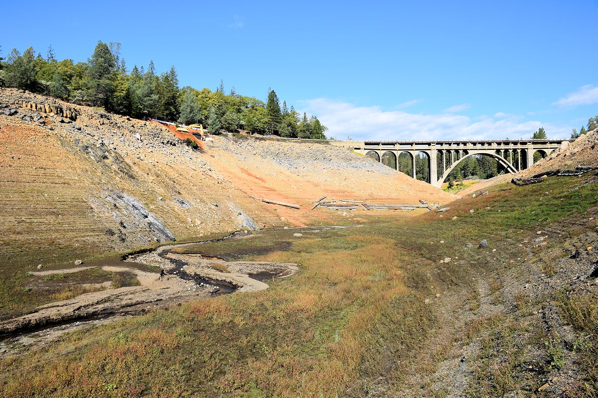
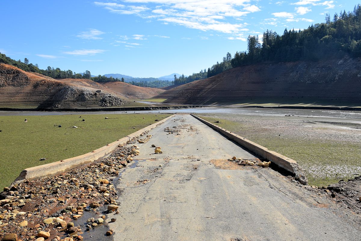
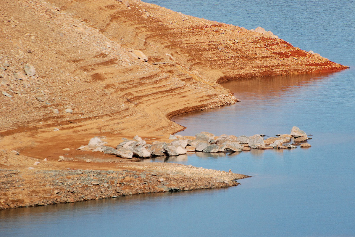
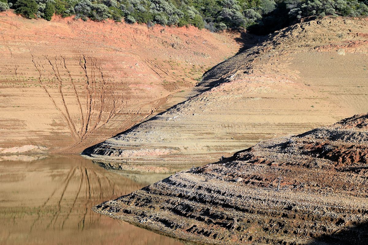
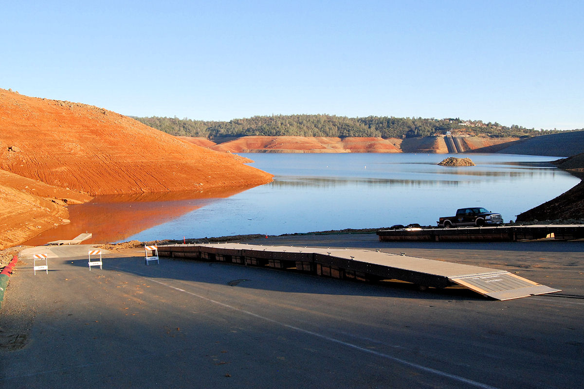
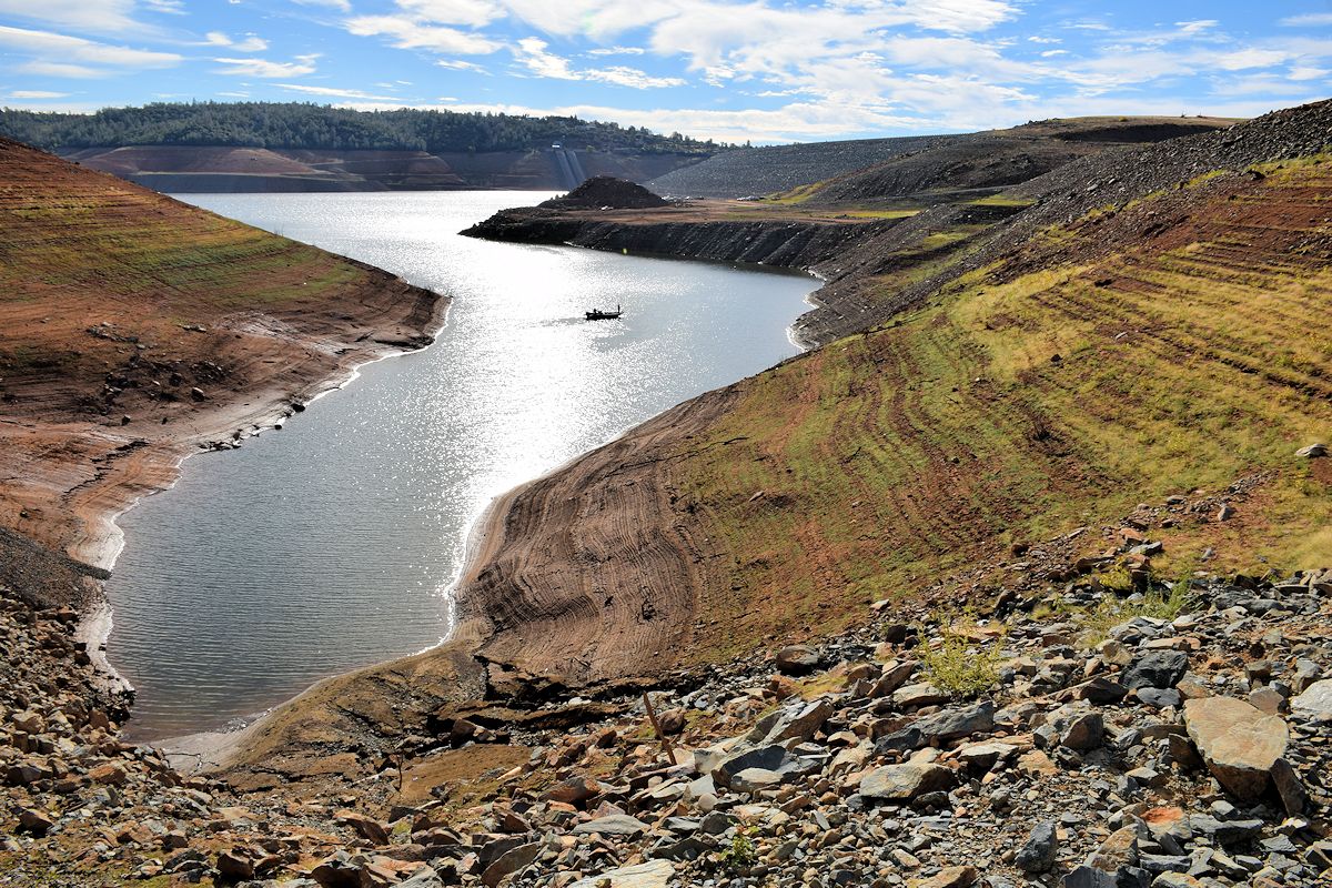
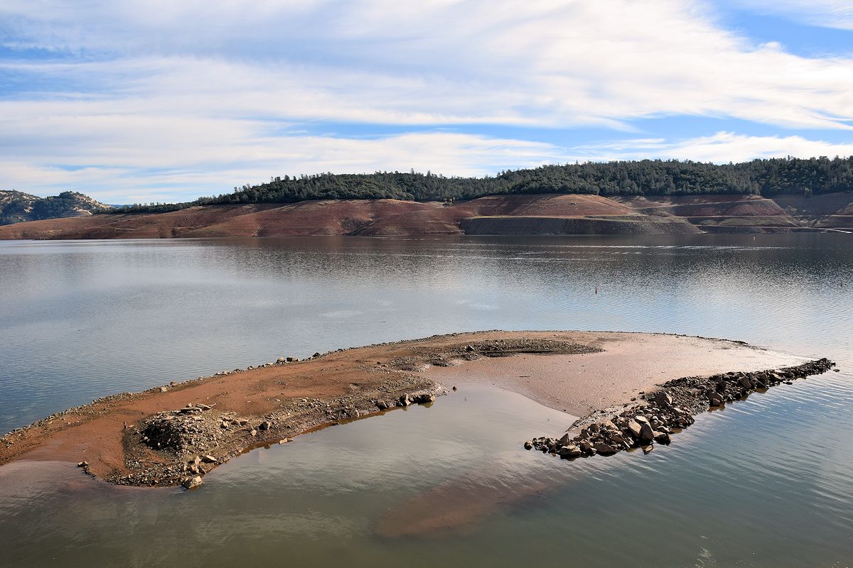
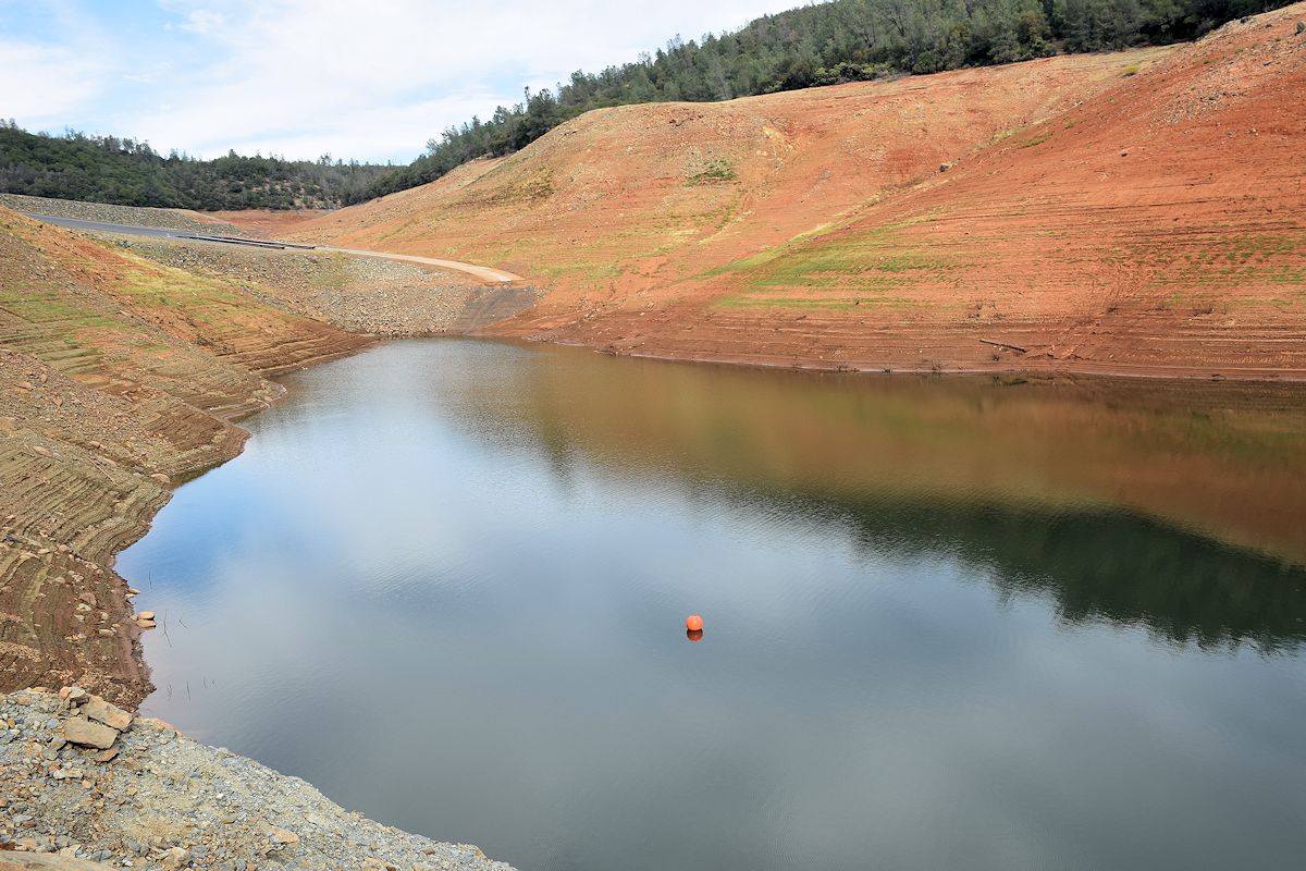
As noted, I also went back to Lake Oroville. A few before/after shots will show it, but there was a small area visible near the path to the spillway that is now completely exposed, and now used as a boat launch. The difference here might be even more dramatic than at Shasta Lake.
I’ll begin with a before/after. First one, again, was taken in February.
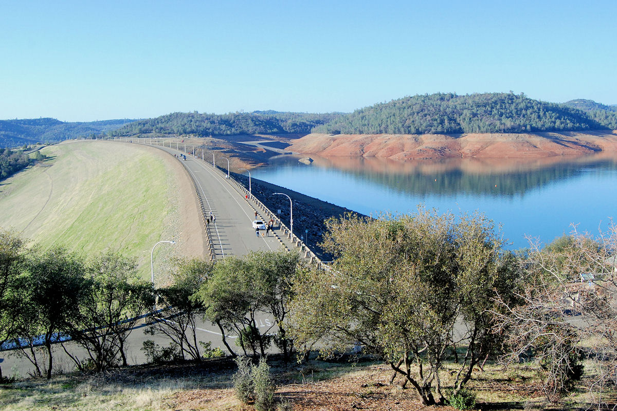
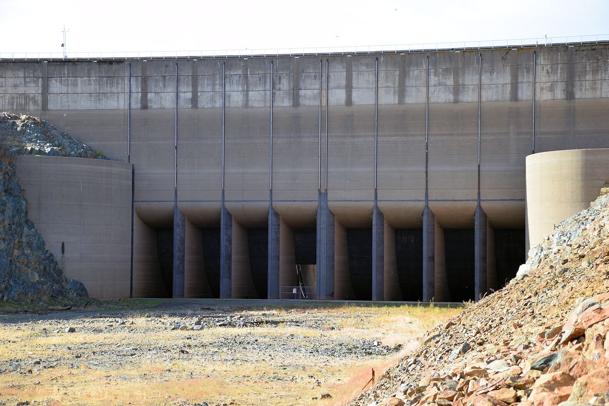
You can see the usual boat launch in the background, but what may not be clear is that’s the secondary one. You can see the usual parking lot with the other one a little lower, and you can just make out where the barrier is to keep people away from the dam’s gates. A bit closer shows what’s available now along with the new intakes that are currently not being worked on further.

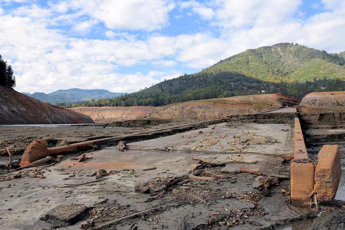
This is the primary boat launch. I have no idea how long it will be before it’s used again.
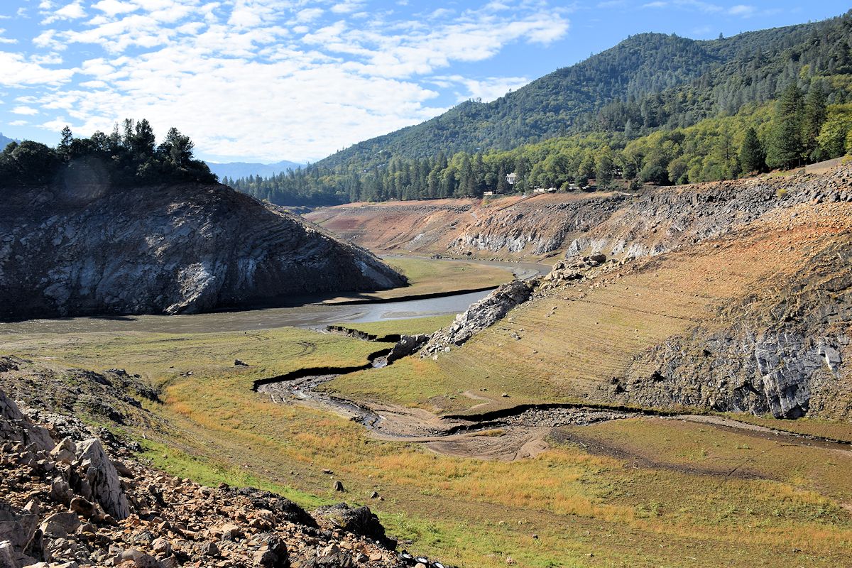
The next two aren’t a perfect match for positioning but it does an effective job of showing the level in February compared to now.
You could do a little fishing in this area, but that’s about it.
That pile of dirt and rock in the upper middle of the shot above is all that was visible in February. I didn’t take a shot from a comparable angle this time, but here’s what it looked like then.
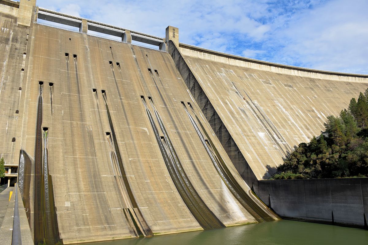
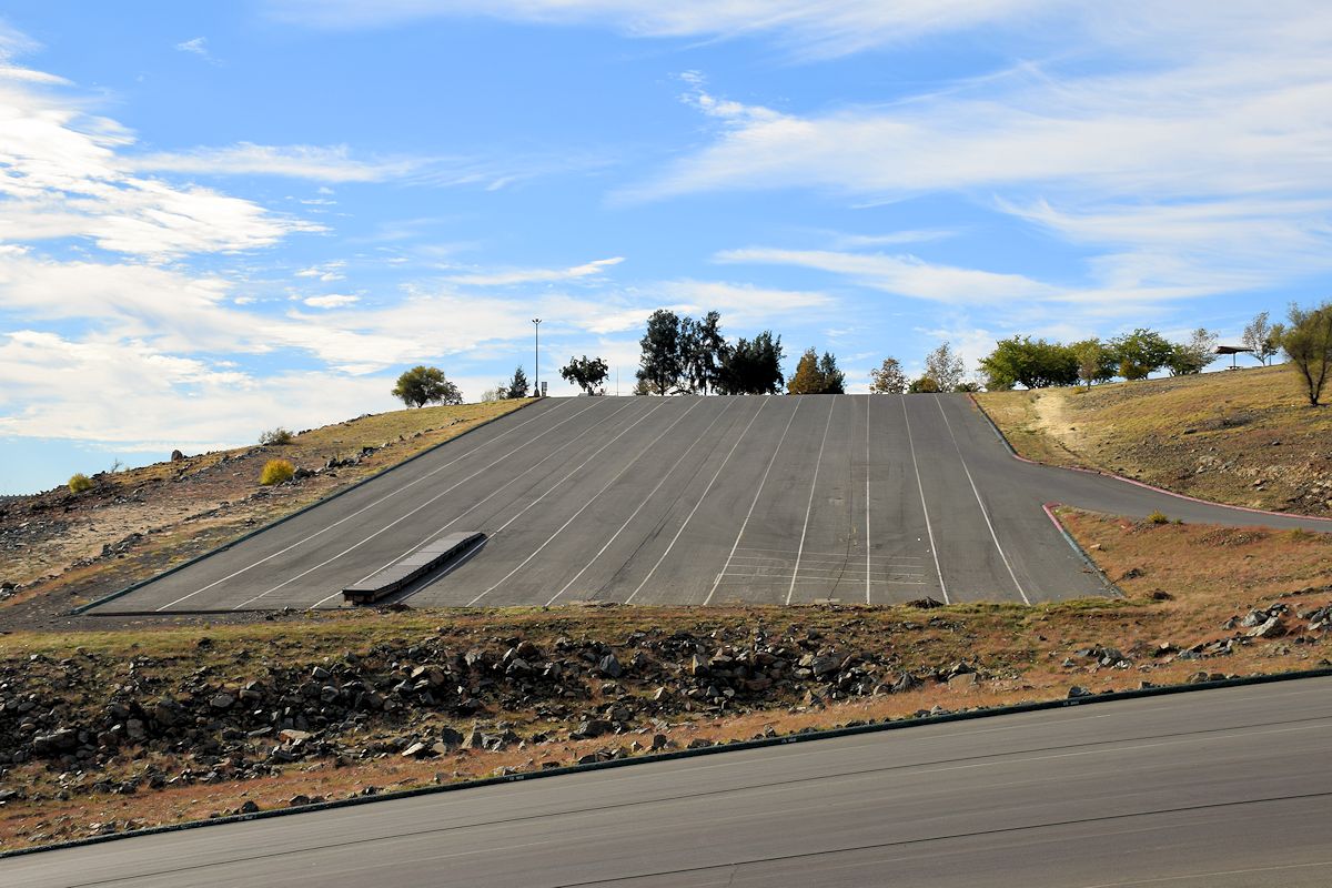
The very dry gates of the dam.
Looked a bit different when I stopped by in September 2011. So did the upper boat launch, for that matter.
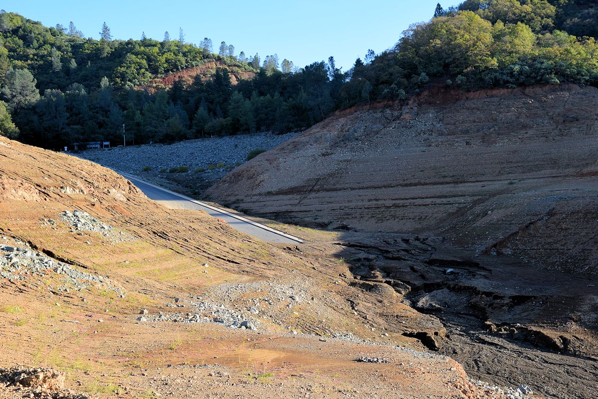
Back to last week. The gravel road at the left leads down to the current boat launch, while the flat area to the right is the approach to the gates. It’s hard to describe just what a difference in elevation that is.
Want to go boating on Lake Oroville now? This is how to do it. They just have to keep extending it the lower the lake gets.

Intakes, both new (technically) and old. I imagine if they do finish these, they’ll have to be raised further up the sides there in order to handle the higher levels once the reservoir eventually fills back up again.
A few more to finish it up.

If you’re still here and want to see a few moving pictures, I’ve got you covered. These and much more here.
This is so cool. (the photo tour, not the drought)
I kinda want to scratch “Ed 2022” in one of the exposed tunnels.
That would be funny.
Great, albeit troubling, photos
This is awesome. Do you have it posted anywhere else so that I might give the link to people who I don’t necessarily want to find FK?
Also, some of the Shasta stuff would be of interest on the roadgeek thread. Some selective reposting would be appropriate with your permission.
I don’t mind. Link me if you do, just so I could see any feedback?
In my gonealookin costume I shrunk three of your pics and reposted them in the AARoads thread I linked above, also linking back to this thread.
Not in written form like this, but I did link to the Flickr site I have if you want to point anyone to that.
However, title should have been “Dam It All 2: Hell”.
Haha.